
- Start >
- Rivers >
- Waterlevel >
- Bayern >
- Wechterswinkel >
- Chart of month

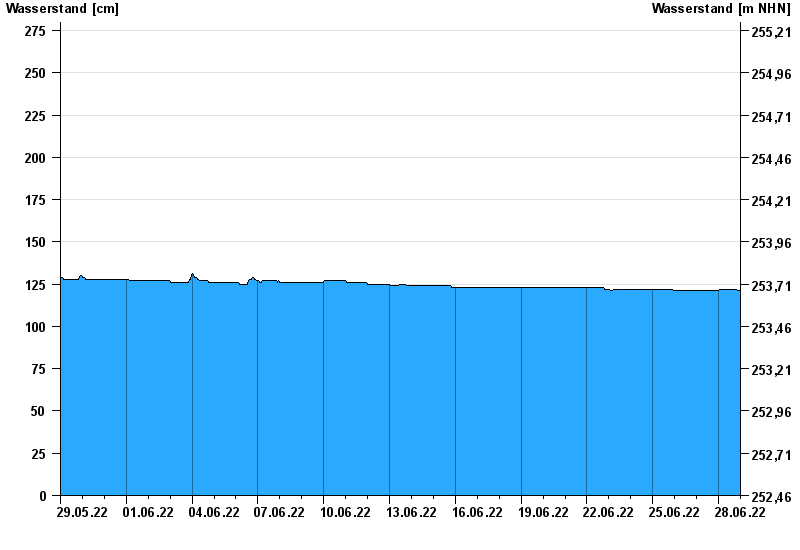
Chart of month Wechterswinkel / Els
Waterlevel from 29.05.2022 to 28.06.2022
- 02.01.2003 Wasserstand: 305 cm
- 23.12.2012 Wasserstand: 300 cm
- 13.01.2011 Wasserstand: 296 cm
- 12.02.2005 Wasserstand: 293 cm
- 19.01.2007 Wasserstand: 279 cm
| Date | Waterlevel [cm] |
|---|---|
| 29.06.2022 00:45 | 121 |
| 29.06.2022 00:30 | 121 |
| 29.06.2022 00:15 | 121 |
| 29.06.2022 00:00 | 121 |
| 28.06.2022 23:45 | 121 |
| 28.06.2022 23:30 | 121 |
| 28.06.2022 23:15 | 121 |
© Bayerisches Landesamt für Umwelt 2024