
- Start >
- Rivers >
- Waterlevel >
- Bayern >
- Waldstetten >
- Chart of year

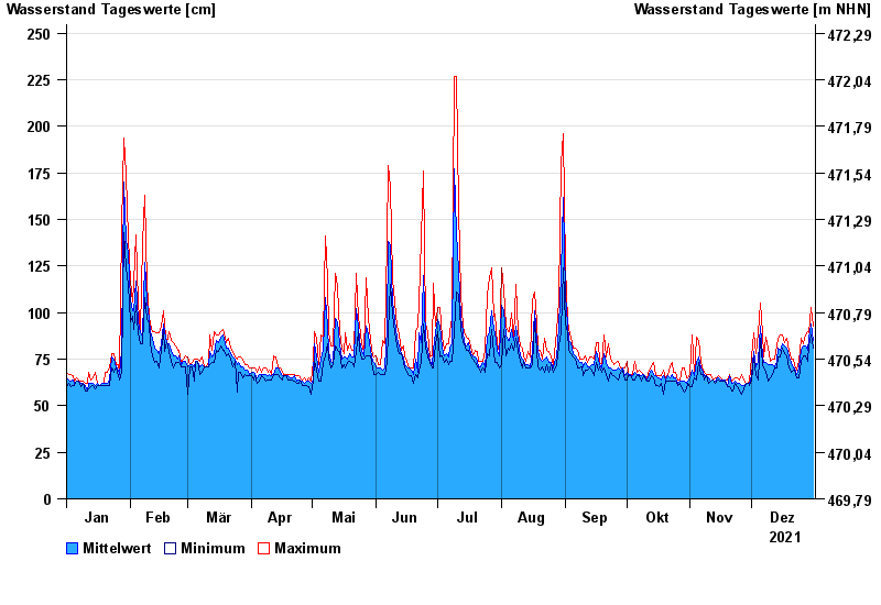
Chart of year Waldstetten / Günz
Waterlevel from 01.01.2021 to 31.12.2021
- 12.08.2002 Wasserstand: 279 cm
- 11.06.2013 Wasserstand: 270 cm
- 19.06.1991 Wasserstand: 265 cm
- 22.09.2000 Wasserstand: 256 cm
- 30.05.2007 Wasserstand: 255 cm
| Date | Mean value [cm] | Maximum [cm] | Minimum [cm] |
|---|---|---|---|
| 31.12.2021 | 85 | 93 | 81 |
| 30.12.2021 | 94 | 103 | 88 |
| 29.12.2021 | 86 | 89 | 82 |
| 28.12.2021 | 80 | 90 | 74 |
| 27.12.2021 | 82 | 88 | 77 |
| 26.12.2021 | 82 | 83 | 77 |
| 25.12.2021 | 80 | 86 | 74 |
© Bayerisches Landesamt für Umwelt 2024