
- Start >
- Rivers >
- Waterlevel >
- Bayern >
- Waldstetten >
- Chart of month

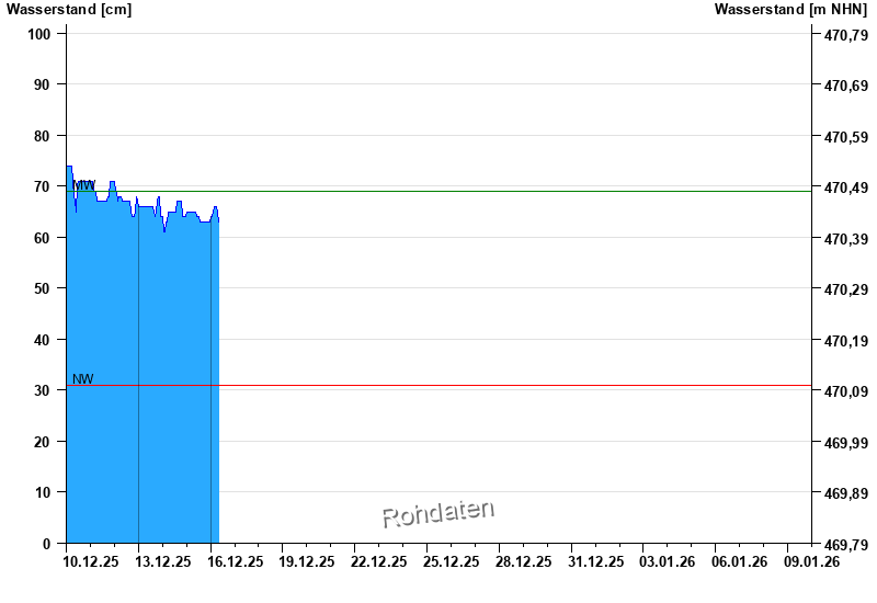
Chart of month Waldstetten / Günz
Waterlevel from 10.12.2025 to 09.01.2026
| Date | Waterlevel [cm] |
|---|---|
| 16.12.2025 01:00 | 64 |
| 16.12.2025 00:45 | 64 |
| 16.12.2025 00:30 | 64 |
| 16.12.2025 00:15 | 64 |
| 16.12.2025 00:00 | 63 |
| 15.12.2025 23:45 | 63 |
| 15.12.2025 23:30 | 63 |
© Bayerisches Landesamt für Umwelt 2025