
- Start >
- Rivers >
- Waterlevel >
- Bayern >
- Waldsassen >
- Chart of month

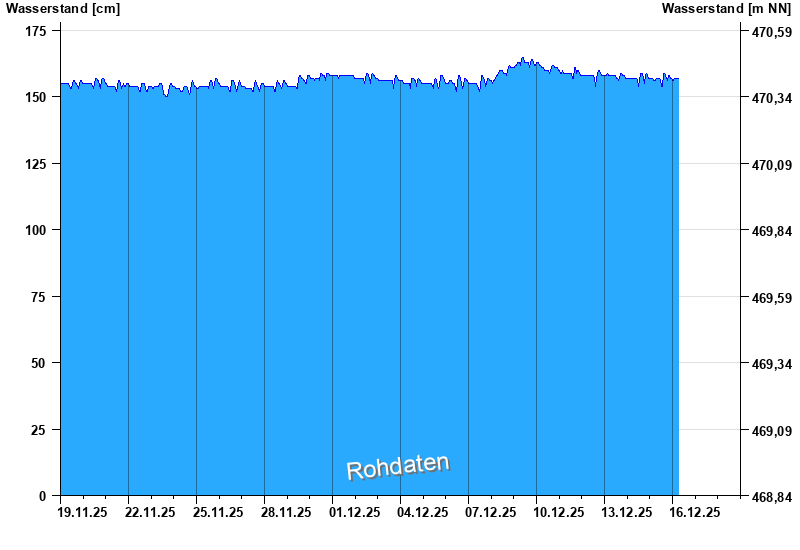
Chart of month Waldsassen / Wondreb
Waterlevel from 19.11.2025 to 18.12.2025
| Date | Waterlevel [cm] |
|---|---|
| 15.12.2025 23:00 | 157 |
| 15.12.2025 22:45 | 157 |
| 15.12.2025 22:30 | 157 |
| 15.12.2025 22:15 | 157 |
| 15.12.2025 22:00 | 157 |
| 15.12.2025 21:45 | 157 |
| 15.12.2025 21:30 | 157 |
© Bayerisches Landesamt für Umwelt 2025