
- Start >
- Rivers >
- Waterlevel >
- Bayern >
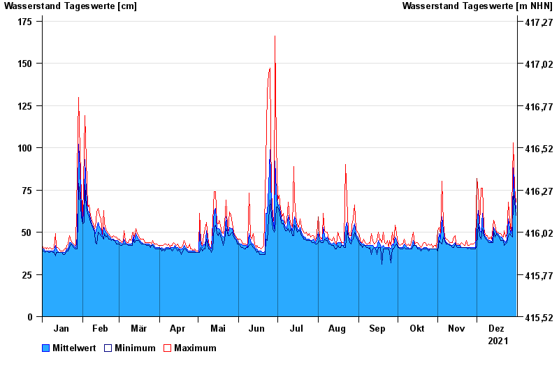
- Viechtach Reibenmühle >
- Chart of year

Chart of year Viechtach Reibenmühle / Aitnach
Waterlevel from 01.01.2021 to 31.12.2021
- 06.01.1982 Wasserstand: 224 cm
- 01.11.1998 Wasserstand: 218 cm
- 17.08.2001 Wasserstand: 207 cm
- 03.12.2007 Wasserstand: 200 cm
- 05.12.1988 Wasserstand: 193 cm
| Date | Mean value [cm] | Maximum [cm] | Minimum [cm] |
|---|---|---|---|
| 31.12.2021 | 64 | 68 | 60 |
| 30.12.2021 | 72 | 76 | 68 |
| 29.12.2021 | 88 | 103 | 73 |
| 28.12.2021 | 54 | 82 | 47 |
| 27.12.2021 | 49 | 50 | 48 |
| 26.12.2021 | 52 | 57 | 49 |
| 25.12.2021 | 58 | 68 | 48 |
© Bayerisches Landesamt für Umwelt 2024