
- Start >
- Rivers >
- Waterlevel >
- Bayern >
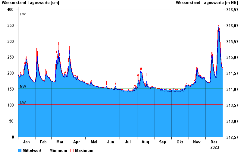
- Untersteinach >
- Chart of year

Chart of year Untersteinach / Schorgast
Waterlevel from 01.01.2023 to 31.12.2023
note
Schlechte Netzanbindung
| Date | Mean value [cm] | Maximum [cm] | Minimum [cm] |
|---|---|---|---|
| 31.12.2023 | 212 | 215 | 209 |
| 30.12.2023 | 220 | 224 | 215 |
| 29.12.2023 | 230 | 236 | 224 |
| 28.12.2023 | 243 | 253 | 236 |
| 27.12.2023 | 267 | 287 | 253 |
| 26.12.2023 | 307 | 329 | 287 |
| 25.12.2023 | 339 | 344 | 329 |
© Bayerisches Landesamt für Umwelt 2024