
- Start >
- Rivers >
- Waterlevel >
- Bayern >
- Unterbruck >
- Chart of month

Chart of month Unterbruck / Haidenaab
Waterlevel from 01.06.2023 to 01.07.2023
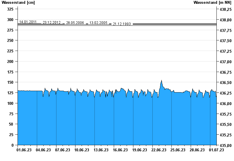
- 14.01.2011 Wasserstand: 290 cm
- 23.12.2012 Wasserstand: 289 cm
- 28.05.2006 Wasserstand: 288 cm
- 13.02.2005 Wasserstand: 288 cm
- 21.12.1993 Wasserstand: 285 cm
| Date | Waterlevel [cm] |
|---|---|
| 02.07.2023 00:45 | 121 |
| 02.07.2023 00:30 | 120 |
| 02.07.2023 00:15 | 119 |
| 02.07.2023 00:00 | 118 |
| 01.07.2023 23:45 | 117 |
| 01.07.2023 23:30 | 116 |
| 01.07.2023 23:15 | 115 |
© Bayerisches Landesamt für Umwelt 2024