
- Start >
- Rivers >
- Waterlevel >
- Bayern >
- Türkheim >
- Chart of year

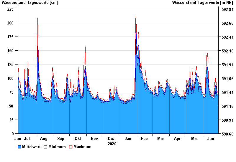
Chart of year Türkheim / Wertach
Waterlevel from 29.06.2020 to 28.06.2021
note
Beeinflussung durch Kraftwerksbetrieb
- 360 cm: Türkheim: Ausuferungen oberhalb Türkheim links.
| Date | Mean value [cm] | Maximum [cm] | Minimum [cm] |
|---|---|---|---|
| 28.06.2021 | 70 | 76 | 68 |
| 27.06.2021 | 70 | 74 | 68 |
| 26.06.2021 | 75 | 83 | 68 |
| 25.06.2021 | 85 | 93 | 74 |
| 24.06.2021 | 83 | 89 | 78 |
| 23.06.2021 | 88 | 103 | 70 |
| 22.06.2021 | 79 | 90 | 74 |
© Bayerisches Landesamt für Umwelt 2024