
- Start >
- Rivers >
- Waterlevel >
- Bayern >
- Trunstadt >
- Chart of year

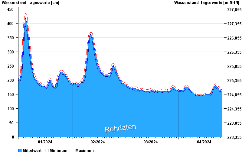
Chart of year Trunstadt / Main
Waterlevel from 01.01.2024 to 26.04.2024
- 04.01.2003 Wasserstand: 714 cm
- 07.01.1982 Wasserstand: 693 cm
- 27.01.1995 Wasserstand: 686 cm
- 15.01.2011 Wasserstand: 681 cm
- 27.03.1988 Wasserstand: 663 cm
| Date | Mean value [cm] | Maximum [cm] | Minimum [cm] |
|---|---|---|---|
| 26.04.2024 | 159 | 159 | 159 |
| 25.04.2024 | 163 | 167 | 159 |
| 24.04.2024 | 168 | 176 | 161 |
| 23.04.2024 | 176 | 181 | 167 |
| 22.04.2024 | 182 | 188 | 175 |
| 21.04.2024 | 173 | 175 | 167 |
| 20.04.2024 | 163 | 168 | 151 |
© Bayerisches Landesamt für Umwelt 2024