
- Start >
- Rivers >
- Waterlevel >
- Bayern >
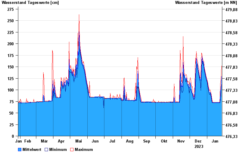
- Trostberg >
- Chart of year

Chart of year Trostberg / Alz
Waterlevel from 28.01.2023 to 27.01.2024
- 12.08.2002 Wasserstand: 490 cm
- 02.06.2013 Wasserstand: 481 cm
- 03.08.1991 Wasserstand: 423 cm
- 26.06.1995 Wasserstand: 401 cm
- 20.07.1981 Wasserstand: 396 cm
| Date | Mean value [cm] | Maximum [cm] | Minimum [cm] |
|---|---|---|---|
| 27.01.2024 | 129 | 152 | 112 |
| 26.01.2024 | 101 | 122 | 86 |
| 25.01.2024 | 98 | 112 | 82 |
| 24.01.2024 | 73 | 82 | 72 |
| 23.01.2024 | 73 | 73 | 72 |
| 22.01.2024 | 73 | 73 | 72 |
| 21.01.2024 | 73 | 73 | 72 |
© Bayerisches Landesamt für Umwelt 2024