
- Start >
- Rivers >
- Waterlevel >
- Bayern >
- Trausnitz u. d. Mühle >
- Chart of year

Chart of year Trausnitz u. d. Mühle / Pfreimd
Waterlevel from 17.04.2024 to 16.04.2025
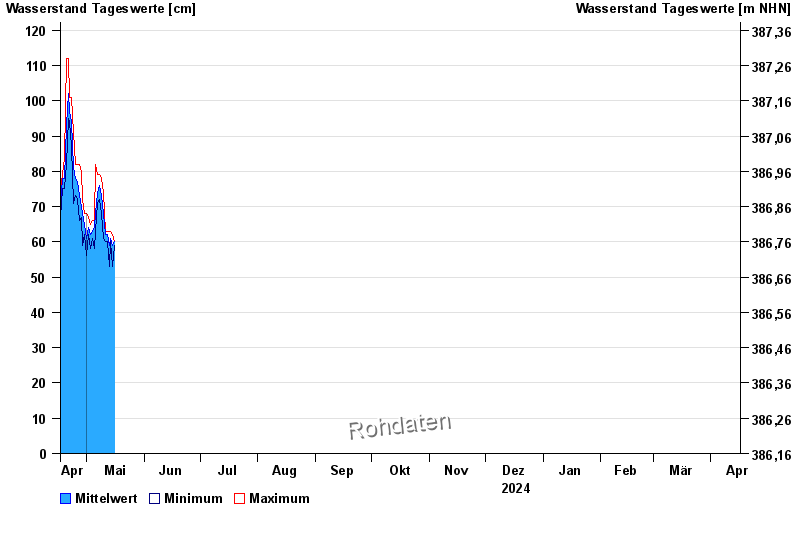
| Date | Mean value [cm] | Maximum [cm] | Minimum [cm] |
|---|---|---|---|
| 05.06.2024 | 105 | 110 | 60 |
| 04.06.2024 | 115 | 121 | 108 |
| 03.06.2024 | 125 | 130 | 121 |
| 02.06.2024 | 127 | 131 | 121 |
| 01.06.2024 | 114 | 139 | 105 |
| 31.05.2024 | 111 | 122 | 101 |
| 30.05.2024 | 123 | 125 | 121 |
© Bayerisches Landesamt für Umwelt 2024