
- Start >
- Rivers >
- Waterlevel >
- Bayern >
- Trauchgau >
- Chart of year

Chart of year Trauchgau / Halblech
Waterlevel from 27.04.2024 to 26.04.2025
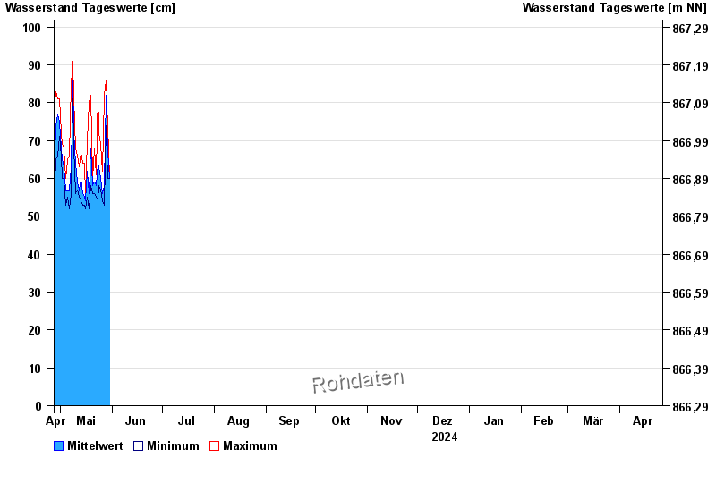
| Date | Mean value [cm] | Maximum [cm] | Minimum [cm] |
|---|---|---|---|
| 08.05.2024 | 87 | 89 | 85 |
| 07.05.2024 | 63 | 85 | 56 |
| 06.05.2024 | 57 | 66 | 52 |
| 05.05.2024 | 57 | 65 | 55 |
| 04.05.2024 | 57 | 60 | 53 |
| 03.05.2024 | 63 | 68 | 60 |
| 02.05.2024 | 65 | 69 | 60 |
© Bayerisches Landesamt für Umwelt 2024