
- Start >
- Rivers >
- Waterlevel >
- Bayern >
- Teisnach >
- Chart of month

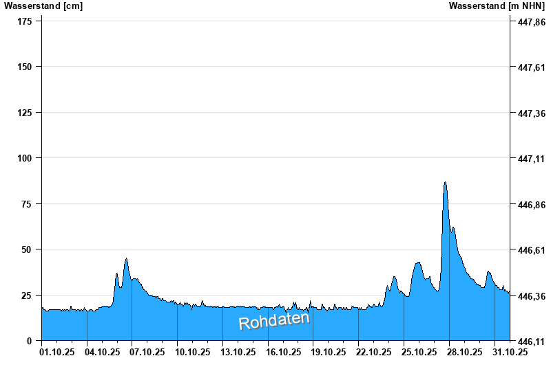
Chart of month Teisnach / Teisnach
Waterlevel from 01.10.2025 to 31.10.2025
- 03.12.2007 Wasserstand: 234 cm
- 16.03.2019 Wasserstand: 224 cm
- 01.03.2008 Wasserstand: 217 cm
- 12.02.2005 Wasserstand: 208 cm
- 22.06.2021 Wasserstand: 207 cm
| Date | Waterlevel [cm] |
|---|---|
| 31.10.2025 23:45 | 27 |
| 31.10.2025 23:30 | 26 |
| 31.10.2025 23:15 | 26 |
| 31.10.2025 23:00 | 26 |
| 31.10.2025 22:45 | 27 |
| 31.10.2025 22:30 | 26 |
| 31.10.2025 22:15 | 26 |
© Bayerisches Landesamt für Umwelt 2025