
- Start >
- Rivers >
- Waterlevel >
- Bayern >
- Steinbach >
- Chart of month

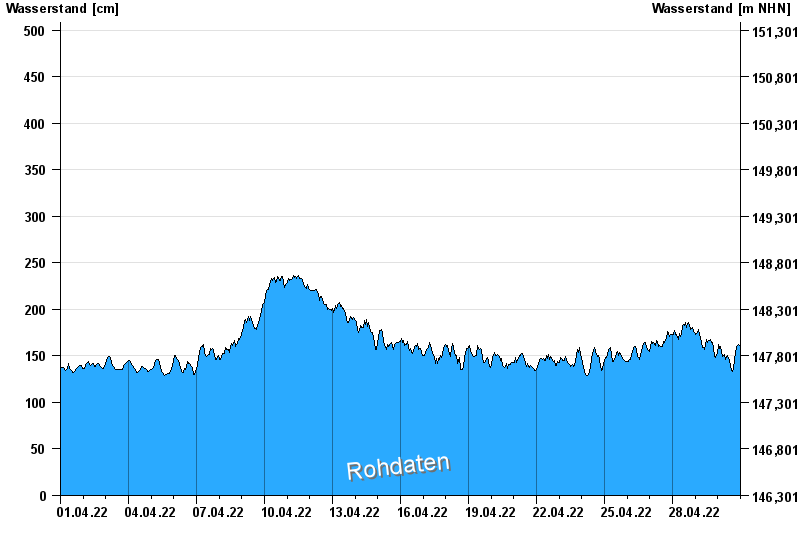
Chart of month Steinbach / Main
Waterlevel from 01.04.2022 to 30.04.2022
- 26.02.1970 Wasserstand: 659 cm
- 29.01.1995 Wasserstand: 656 cm
- 17.01.2011 Wasserstand: 619 cm
- 06.01.2003 Wasserstand: 617 cm
- 29.03.1988 Wasserstand: 616 cm
| Date | Waterlevel [cm] |
|---|---|
| 01.05.2022 00:45 | 160 |
| 01.05.2022 00:30 | 160 |
| 01.05.2022 00:15 | 163 |
| 01.05.2022 00:00 | 160 |
| 30.04.2022 23:45 | 160 |
| 30.04.2022 23:30 | 160 |
| 30.04.2022 23:15 | 161 |
© Bayerisches Landesamt für Umwelt 2024