
- Start >
- Rivers >
- Waterlevel >
- Bayern >
- Steinbach >
- Chart of year

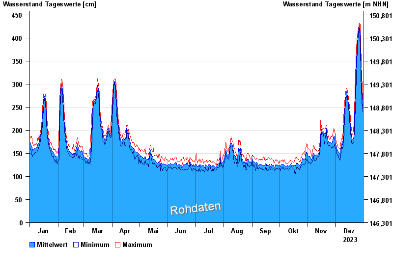
Chart of year Steinbach / Main
Waterlevel from 01.01.2023 to 31.12.2023
- 26.02.1970 Wasserstand: 659 cm
- 29.01.1995 Wasserstand: 656 cm
- 17.01.2011 Wasserstand: 619 cm
- 06.01.2003 Wasserstand: 617 cm
- 29.03.1988 Wasserstand: 616 cm
| Date | Mean value [cm] | Maximum [cm] | Minimum [cm] |
|---|---|---|---|
| 31.12.2023 | 254 | 267 | 240 |
| 30.12.2023 | 288 | 319 | 263 |
| 29.12.2023 | 346 | 381 | 319 |
| 28.12.2023 | 410 | 430 | 382 |
| 27.12.2023 | 428 | 432 | 421 |
| 26.12.2023 | 412 | 421 | 406 |
| 25.12.2023 | 390 | 406 | 377 |
© Bayerisches Landesamt für Umwelt 2024