
- Start >
- Rivers >
- Waterlevel >
- Bayern >
- Schönbrunn >
- Chart of year

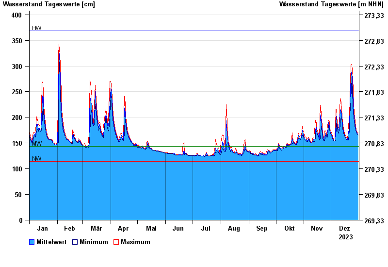
Chart of year Schönbrunn / Rauhe Ebrach
Waterlevel from 01.01.2023 to 31.12.2023
note
Beeinflussung des Abflusses aufgrund Hindernisse im Unterlauf
| Date | Mean value [cm] | Maximum [cm] | Minimum [cm] |
|---|---|---|---|
| 31.12.2023 | 166 | 170 | 165 |
| 30.12.2023 | 169 | 171 | 168 |
| 29.12.2023 | 173 | 176 | 170 |
| 28.12.2023 | 180 | 184 | 176 |
| 27.12.2023 | 190 | 199 | 184 |
| 26.12.2023 | 210 | 223 | 199 |
| 25.12.2023 | 249 | 278 | 223 |
© Bayerisches Landesamt für Umwelt 2024