
- Start >
- Rivers >
- Waterlevel >
- Bayern >
- Schönberg >
- Chart of year

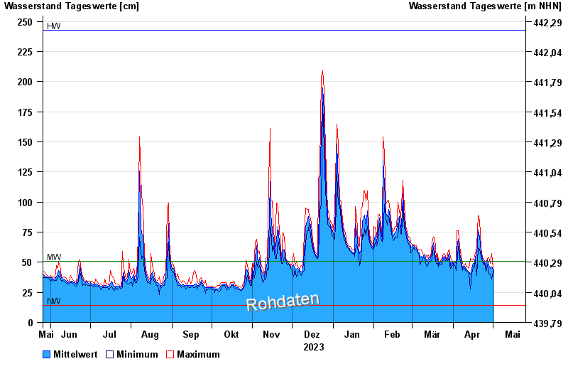
Chart of year Schönberg / Große Ohe
Waterlevel from 26.05.2023 to 25.05.2024
| Date | Mean value [cm] | Maximum [cm] | Minimum [cm] |
|---|---|---|---|
| 25.05.2024 | 59 | 64 | 53 |
| 24.05.2024 | 64 | 76 | 61 |
| 23.05.2024 | 74 | 89 | 65 |
| 22.05.2024 | 129 | 162 | 91 |
| 21.05.2024 | 53 | 116 | 43 |
| 20.05.2024 | 50 | 52 | 46 |
| 19.05.2024 | 53 | 56 | 48 |
© Bayerisches Landesamt für Umwelt 2024