
- Start >
- Rivers >
- Waterlevel >
- Bayern >
- Schmidmühlen >
- Chart of month

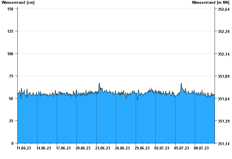
Chart of month Schmidmühlen / Vils
Waterlevel from 11.06.2023 to 10.07.2023
- 02.07.1987 Wasserstand: 294 cm
- 21.12.1993 Wasserstand: 293 cm
- 26.01.1995 Wasserstand: 275 cm
- 03.01.2003 Wasserstand: 266 cm
- 24.02.1970 Wasserstand: 265 cm
| Date | Waterlevel [cm] |
|---|---|
| 11.07.2023 00:45 | 58 |
| 11.07.2023 00:30 | 59 |
| 11.07.2023 00:15 | 56 |
| 11.07.2023 00:00 | 55 |
| 10.07.2023 23:45 | 55 |
| 10.07.2023 23:30 | 55 |
| 10.07.2023 23:15 | 54 |
© Bayerisches Landesamt für Umwelt 2024