
- Start >
- Rivers >
- Waterlevel >
- Bayern >
- Schmerold >
- Chart of month

Chart of month Schmerold / Mangfall
Waterlevel from 19.04.2024 to 18.05.2024
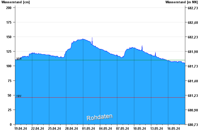
| Date | Waterlevel [cm] |
|---|---|
| 01.05.2024 05:45 | 146 |
| 01.05.2024 05:30 | 145 |
| 01.05.2024 05:15 | 146 |
| 01.05.2024 05:00 | 146 |
| 01.05.2024 04:45 | 145 |
| 01.05.2024 04:30 | 145 |
| 01.05.2024 04:15 | 146 |
© Bayerisches Landesamt für Umwelt 2024