
- Start >
- Rivers >
- Waterlevel >
- Bayern >
- Ruhstorf >
- Chart of year

Chart of year Ruhstorf / Rott
Waterlevel from 09.12.2025 to 08.12.2026
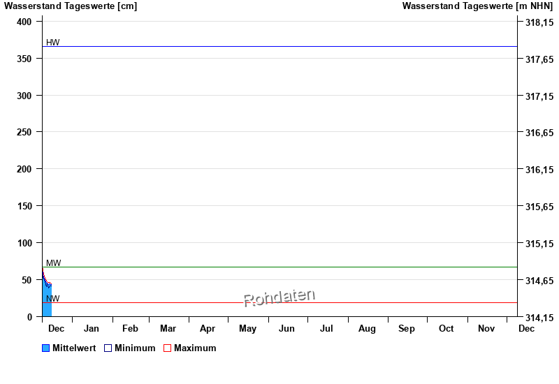
| Date | Mean value [cm] | Maximum [cm] | Minimum [cm] |
|---|---|---|---|
| 16.12.2025 | 44 | 44 | 43 |
| 15.12.2025 | 44 | 46 | 42 |
| 14.12.2025 | 43 | 46 | 39 |
| 13.12.2025 | 45 | 47 | 44 |
| 12.12.2025 | 46 | 48 | 41 |
| 11.12.2025 | 49 | 52 | 47 |
| 10.12.2025 | 53 | 58 | 51 |
© Bayerisches Landesamt für Umwelt 2025