
- Start >
- Rivers >
- Waterlevel >
- Bayern >
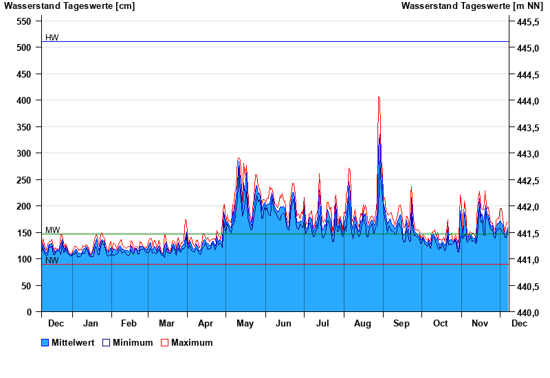
- Rosenheim u.d. Mangfallmündung >
- Chart of year

Chart of year Rosenheim u.d. Mangfallmündung / Inn
Waterlevel from 08.12.2022 to 07.12.2023
| Date | Mean value [cm] | Maximum [cm] | Minimum [cm] |
|---|---|---|---|
| 07.12.2023 | 159 | 169 | 152 |
| 06.12.2023 | 150 | 168 | 140 |
| 05.12.2023 | 145 | 151 | 140 |
| 04.12.2023 | 149 | 154 | 146 |
| 03.12.2023 | 162 | 175 | 148 |
| 02.12.2023 | 168 | 195 | 154 |
| 01.12.2023 | 171 | 195 | 157 |
© Bayerisches Landesamt für Umwelt 2025