
- Start >
- Rivers >
- Waterlevel >
- Bayern >
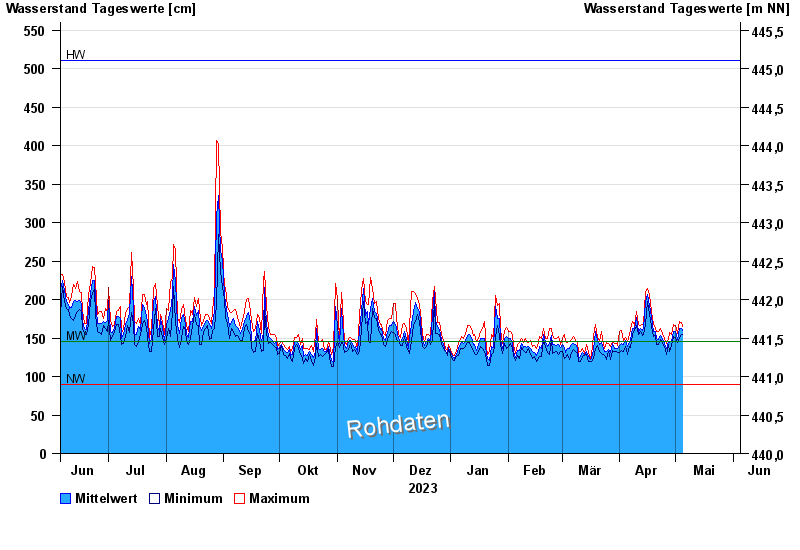
- Rosenheim u.d. Mangfallmündung >
- Chart of year

Chart of year Rosenheim u.d. Mangfallmündung / Inn
Waterlevel from 05.06.2023 to 04.06.2024
| Date | Mean value [cm] | Maximum [cm] | Minimum [cm] |
|---|---|---|---|
| 04.06.2024 | 301 | 372 | 247 |
| 03.06.2024 | 297 | 371 | 245 |
| 02.06.2024 | 247 | 258 | 240 |
| 01.06.2024 | 280 | 299 | 259 |
| 31.05.2024 | 272 | 286 | 241 |
| 30.05.2024 | 225 | 241 | 198 |
| 29.05.2024 | 204 | 222 | 191 |
© Bayerisches Landesamt für Umwelt 2024