
- Start >
- Rivers >
- Waterlevel >
- Bayern >
- Rosenheim u.d. Mangfallmündung >
- Chart of year

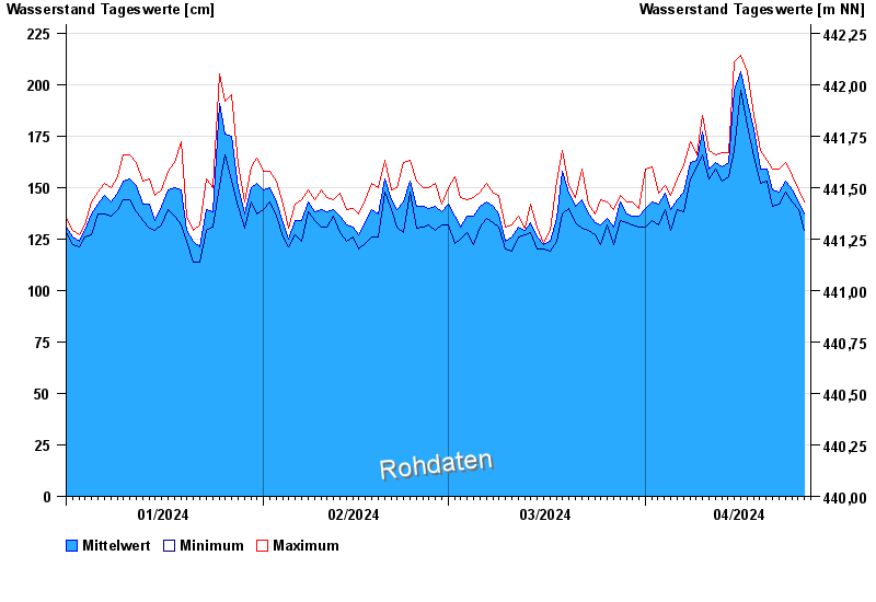
Chart of year Rosenheim u.d. Mangfallmündung / Inn
Waterlevel from 01.01.2024 to 26.04.2024
 Für diesen Pegel sind keine Meldestufen hinterlegt.
| Date | Mean value [cm] | Maximum [cm] | Minimum [cm] |
|---|---|---|---|
| 26.04.2024 | 135 | 140 | 129 |
| 25.04.2024 | 143 | 149 | 139 |
| 24.04.2024 | 149 | 156 | 143 |
| 23.04.2024 | 153 | 162 | 148 |
| 22.04.2024 | 148 | 159 | 142 |
| 21.04.2024 | 149 | 159 | 141 |
| 20.04.2024 | 159 | 163 | 153 |
© Bayerisches Landesamt für Umwelt 2024