
- Start >
- Rivers >
- Waterlevel >
- Bayern >
- Rosenheim u.d. Mangfallmündung >
- Chart of year

Chart of year Rosenheim u.d. Mangfallmündung / Inn
Waterlevel from 30.03.2024 to 29.03.2025
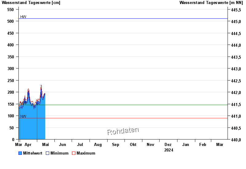
| Date | Mean value [cm] | Maximum [cm] | Minimum [cm] |
|---|---|---|---|
| 14.05.2024 | 190 | 191 | 189 |
| 13.05.2024 | 184 | 189 | 175 |
| 12.05.2024 | 174 | 177 | 168 |
| 11.05.2024 | 177 | 182 | 168 |
| 10.05.2024 | 177 | 183 | 174 |
| 09.05.2024 | 198 | 225 | 177 |
| 08.05.2024 | 219 | 230 | 193 |
© Bayerisches Landesamt für Umwelt 2024