
- Start >
- Rivers >
- Waterlevel >
- Bayern >
- Rötz Speicherzufluss >
- Chart of year

Chart of year Rötz Speicherzufluss / Schwarzach
Waterlevel from 30.03.2024 to 29.03.2025
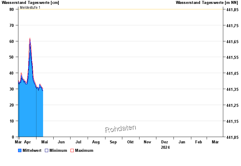
- Meldestufe 1 80 cm
- Meldestufe 2 95 cm
- Meldestufe 3 160 cm
- Meldestufe 4 180 cm
| Date | Mean value [cm] | Maximum [cm] | Minimum [cm] |
|---|---|---|---|
| 28.04.2024 | 34 | 35 | 33 |
| 27.04.2024 | 35 | 36 | 34 |
| 26.04.2024 | 36 | 38 | 35 |
| 25.04.2024 | 39 | 43 | 37 |
| 24.04.2024 | 44 | 46 | 42 |
| 23.04.2024 | 47 | 48 | 45 |
| 22.04.2024 | 52 | 57 | 48 |
© Bayerisches Landesamt für Umwelt 2024