
- Start >
- Rivers >
- Waterlevel >
- Bayern >
- Reupelsdorf >
- Chart of month

Chart of month Reupelsdorf / Schwarzach
Waterlevel from 01.05.2024 to 08.05.2024
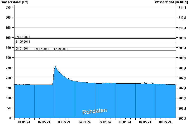
- 09.07.2021 Wasserstand: 395 cm
- 31.05.2013 Wasserstand: 372 cm
- 08.01.2011 Wasserstand: 338 cm
- 09.12.2010 Wasserstand: 336 cm
- 12.09.2005 Wasserstand: 336 cm
| Date | Waterlevel [cm] |
|---|---|
| 08.05.2024 23:45 | 166 |
| 08.05.2024 23:30 | 166 |
| 08.05.2024 23:15 | 166 |
| 08.05.2024 23:00 | 166 |
| 08.05.2024 22:45 | 167 |
| 08.05.2024 22:30 | 167 |
| 08.05.2024 22:15 | 167 |
© Bayerisches Landesamt für Umwelt 2024