
- Start >
- Rivers >
- Waterlevel >
- Bayern >
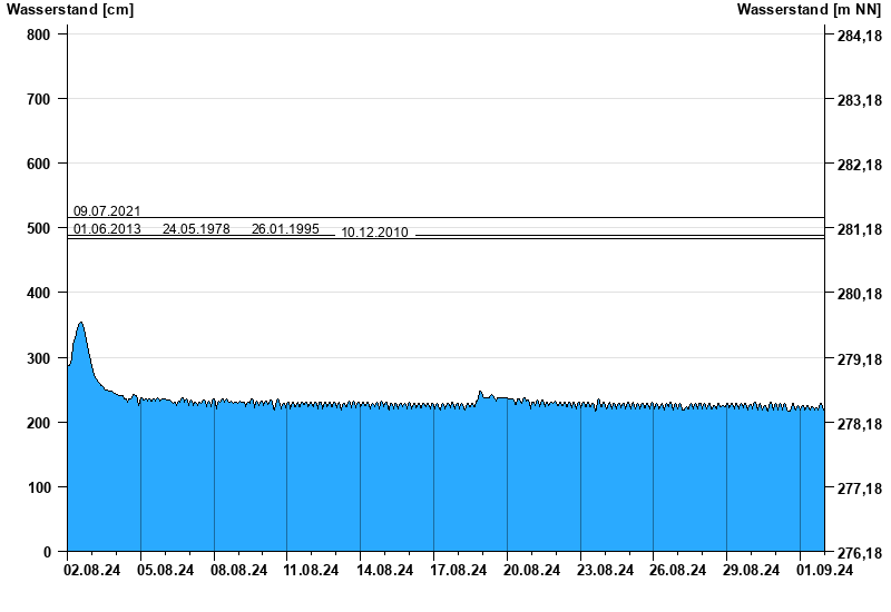
- Rappoldshofen >
- Chart of month

Chart of month Rappoldshofen / Aisch
Waterlevel from 02.08.2024 to 01.09.2024
note
Datenübertragung Geber 1 fällt zeitweise aus.
- 09.07.2021 Wasserstand: 516 cm
- 01.06.2013 Wasserstand: 489 cm
- 24.05.1978 Wasserstand: 489 cm
- 26.01.1995 Wasserstand: 488 cm
- 10.12.2010 Wasserstand: 483 cm
| Date | Waterlevel [cm] |
|---|---|
| 02.09.2024 00:45 | 225 |
| 02.09.2024 00:30 | 225 |
| 02.09.2024 00:15 | 224 |
| 02.09.2024 00:00 | 224 |
| 01.09.2024 23:45 | 223 |
| 01.09.2024 23:30 | 221 |
| 01.09.2024 23:15 | 219 |
© Bayerisches Landesamt für Umwelt 2025