
- Start >
- Rivers >
- Waterlevel >
- Bayern >
- Puppling >
- Chart of month

Chart of month Puppling / Isar
Waterlevel from 08.07.2025 to 07.08.2025
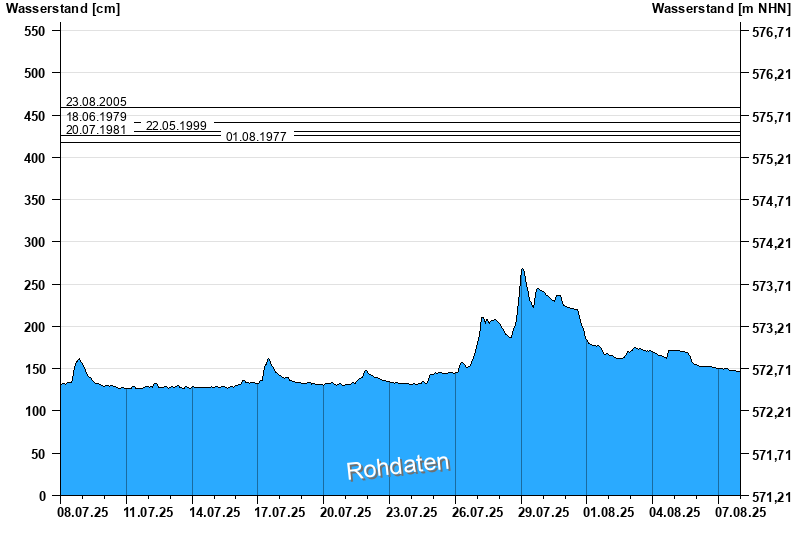
- 23.08.2005 Wasserstand: 459 cm
- 18.06.1979 Wasserstand: 441 cm
- 22.05.1999 Wasserstand: 430 cm
- 20.07.1981 Wasserstand: 426 cm
- 01.08.1977 Wasserstand: 418 cm
| Date | Waterlevel [cm] |
|---|---|
| 08.08.2025 00:45 | 147 |
| 08.08.2025 00:30 | 147 |
| 08.08.2025 00:15 | 147 |
| 08.08.2025 00:00 | 147 |
| 07.08.2025 23:45 | 147 |
| 07.08.2025 23:30 | 147 |
| 07.08.2025 23:15 | 147 |
© Bayerisches Landesamt für Umwelt 2025