
- Start >
- Rivers >
- Waterlevel >
- Bayern >
- Pottenstein >
- Chart of month

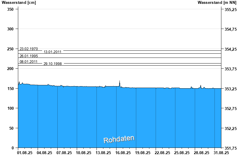
Chart of month Pottenstein / Püttlach
Waterlevel from 01.08.2025 to 31.08.2025
note
Abfluss durch starke Verkrautung behindert; Abflusswerte unsicher
- 23.02.1970 Wasserstand: 245 cm
- 13.01.2011 Wasserstand: 238 cm
- 26.01.1995 Wasserstand: 227 cm
- 08.01.2011 Wasserstand: 213 cm
- 29.10.1998 Wasserstand: 208 cm
| Date | Waterlevel [cm] |
|---|---|
| 01.09.2025 00:45 | 149 |
| 01.09.2025 00:30 | 149 |
| 01.09.2025 00:15 | 149 |
| 01.09.2025 00:00 | 149 |
| 31.08.2025 23:45 | 149 |
| 31.08.2025 23:30 | 149 |
| 31.08.2025 23:15 | 149 |
© Bayerisches Landesamt für Umwelt 2025