
- Start >
- Rivers >
- Waterlevel >
- Bayern >
- Pfelling >
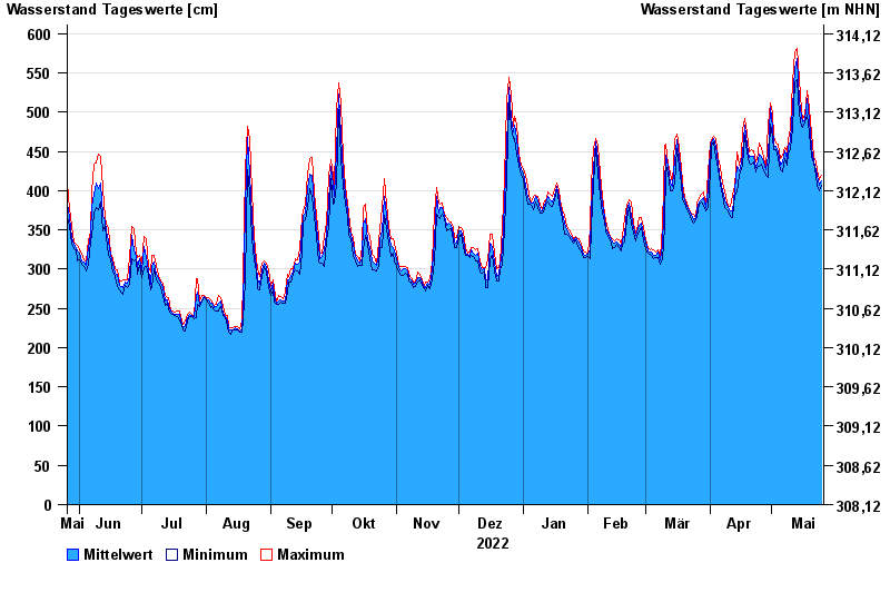
- Chart of year

Chart of year Pfelling / Donau
Waterlevel from 26.05.2022 to 25.05.2023
| Date | Mean value [cm] | Maximum [cm] | Minimum [cm] |
|---|---|---|---|
| 25.05.2023 | 412 | 419 | 407 |
| 24.05.2023 | 407 | 414 | 400 |
| 23.05.2023 | 418 | 427 | 407 |
| 22.05.2023 | 426 | 436 | 420 |
| 21.05.2023 | 437 | 444 | 435 |
| 20.05.2023 | 455 | 473 | 444 |
| 19.05.2023 | 489 | 504 | 473 |
© Bayerisches Landesamt für Umwelt 2024