
- Start >
- Rivers >
- Waterlevel >
- Bayern >
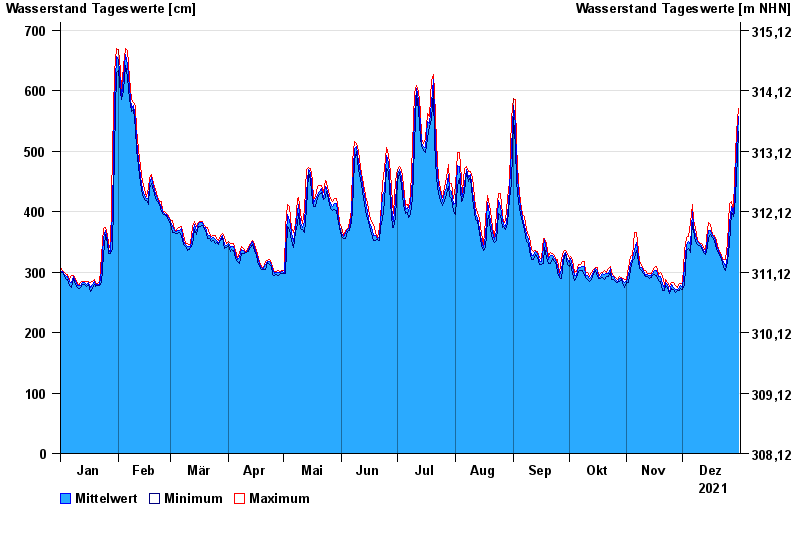
- Pfelling >
- Chart of year

Chart of year Pfelling / Donau
Waterlevel from 01.01.2021 to 31.12.2021
- 05.06.2013 Wasserstand: 898 cm
- 28.01.1941 Wasserstand: 856 cm
- 15.08.2002 Wasserstand: 847 cm
- 28.03.1988 Wasserstand: 837 cm
- 16.01.2011 Wasserstand: 827 cm
| Date | Mean value [cm] | Maximum [cm] | Minimum [cm] |
|---|---|---|---|
| 31.12.2021 | 557 | 571 | 532 |
| 30.12.2021 | 501 | 532 | 455 |
| 29.12.2021 | 420 | 455 | 400 |
| 28.12.2021 | 396 | 402 | 392 |
| 27.12.2021 | 408 | 416 | 399 |
| 26.12.2021 | 380 | 414 | 348 |
| 25.12.2021 | 326 | 348 | 318 |
© Bayerisches Landesamt für Umwelt 2024