
- Start >
- Rivers >
- Waterlevel >
- Bayern >
- Partenstein >
- Chart of total period

Chart of total period Partenstein / Lohr
Waterlevel from 01.11.1963 to 06.05.2024
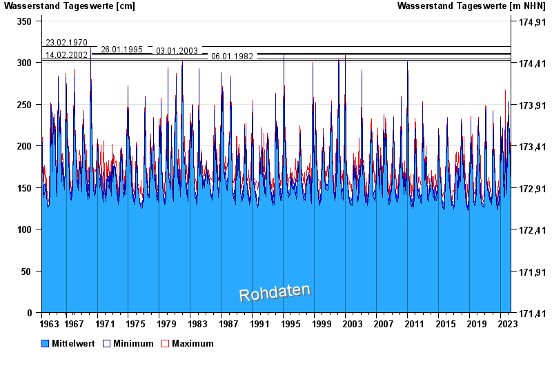
- 23.02.1970 Wasserstand: 319 cm
- 26.01.1995 Wasserstand: 311 cm
- 03.01.2003 Wasserstand: 309 cm
- 14.02.2002 Wasserstand: 304 cm
- 06.01.1982 Wasserstand: 303 cm
| Date | Mean value [cm] | Maximum [cm] | Minimum [cm] |
|---|---|---|---|
| 06.05.2024 | 164 | 165 | 163 |
| 05.05.2024 | 169 | 178 | 161 |
| 04.05.2024 | 162 | 164 | 161 |
| 03.05.2024 | 166 | 168 | 164 |
| 02.05.2024 | 165 | 167 | 165 |
| 01.05.2024 | 166 | 168 | 165 |
| 30.04.2024 | 166 | 167 | 165 |
© Bayerisches Landesamt für Umwelt 2024