
- Start >
- Rivers >
- Waterlevel >
- Bayern >
- Münnerstadt >
- Chart of month

Chart of month Münnerstadt / Lauer
Waterlevel from 17.04.2024 to 16.05.2024
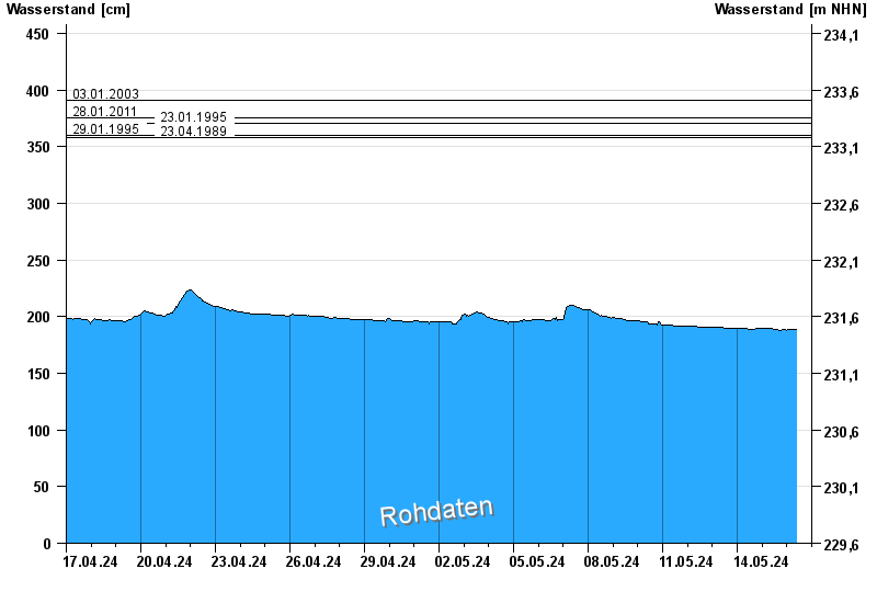
- 03.01.2003 Wasserstand: 391 cm
- 28.01.2011 Wasserstand: 375 cm
- 23.01.1995 Wasserstand: 371 cm
- 29.01.1995 Wasserstand: 360 cm
- 23.04.1989 Wasserstand: 358 cm
| Date | Waterlevel [cm] |
|---|---|
| 29.04.2024 19:30 | 195 |
| 29.04.2024 19:15 | 196 |
| 29.04.2024 19:00 | 196 |
| 29.04.2024 18:45 | 196 |
| 29.04.2024 18:30 | 196 |
| 29.04.2024 18:15 | 196 |
| 29.04.2024 18:00 | 196 |
© Bayerisches Landesamt für Umwelt 2024