
- Start >
- Rivers >
- Waterlevel >
- Bayern >
- Marktleuthen >
- Chart of month

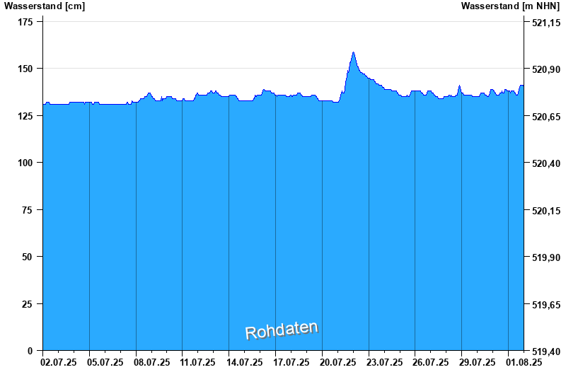
Chart of month Marktleuthen / Eger
Waterlevel from 02.07.2025 to 01.08.2025
- Hochwassergefahrenfläche HQhäufig 330 cm
| Date | Waterlevel [cm] |
|---|---|
| 02.08.2025 00:45 | 140 |
| 02.08.2025 00:30 | 141 |
| 02.08.2025 00:15 | 141 |
| 02.08.2025 00:00 | 141 |
| 01.08.2025 23:45 | 140 |
| 01.08.2025 23:30 | 140 |
| 01.08.2025 23:15 | 140 |
© Bayerisches Landesamt für Umwelt 2025