
- Start >
- Rivers >
- Waterlevel >
- Bayern >
- Lierheim >
- Current values

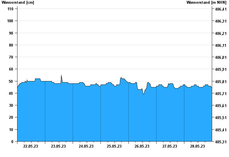
Current values Lierheim / Eger
Waterlevel from 22.05.2023 to 28.05.2023
note
Abflussermittlung beeinflusst!
- 31.01.1982 Wasserstand: 340 cm
- 07.06.1984 Wasserstand: 339 cm
- 13.04.1994 Wasserstand: 335 cm
- 21.12.1993 Wasserstand: 328 cm
- 16.02.1990 Wasserstand: 323 cm
| Date | Waterlevel [cm] |
|---|---|
| 29.05.2023 00:45 | 45 |
| 29.05.2023 00:30 | 45 |
| 29.05.2023 00:15 | 45 |
| 29.05.2023 00:00 | 45 |
| 28.05.2023 23:45 | 45 |
| 28.05.2023 23:30 | 45 |
| 28.05.2023 23:15 | 45 |
© Bayerisches Landesamt für Umwelt 2024