
- Start >
- Rivers >
- Waterlevel >
- Bayern >
- Langengeisling >
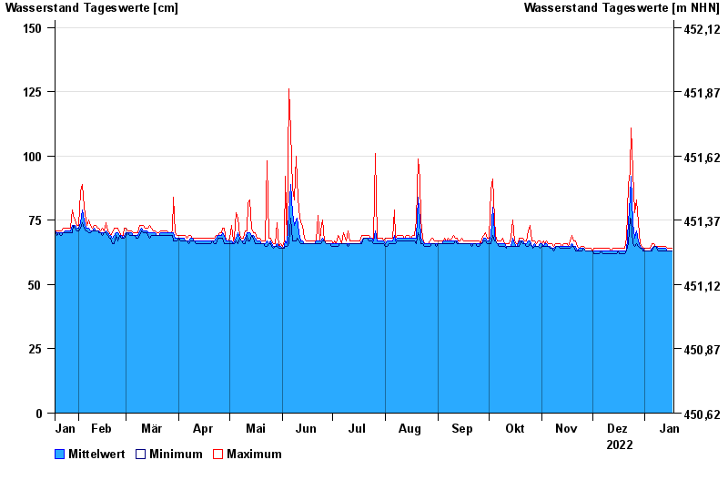
- Chart of year

Chart of year Langengeisling / Saubach
Waterlevel from 18.01.2022 to 17.01.2023
- 03.06.2013 Wasserstand: 209 cm
- 02.08.1991 Wasserstand: 180 cm
- 15.02.1990 Wasserstand: 172 cm
- 07.06.1995 Wasserstand: 171 cm
- 31.01.1982 Wasserstand: 167 cm
| Date | Mean value [cm] | Maximum [cm] | Minimum [cm] |
|---|---|---|---|
| 17.01.2023 | 63 | 64 | 63 |
| 16.01.2023 | 63 | 64 | 63 |
| 15.01.2023 | 63 | 64 | 63 |
| 14.01.2023 | 63 | 64 | 63 |
| 13.01.2023 | 64 | 65 | 63 |
| 12.01.2023 | 64 | 65 | 63 |
| 11.01.2023 | 64 | 65 | 63 |
© Bayerisches Landesamt für Umwelt 2024