
- Start >
- Rivers >
- Waterlevel >
- Bayern >
- Kösfeld >
- Chart of year

Chart of year Kösfeld / Sulzbach
Waterlevel from 01.01.2021 to 31.12.2021
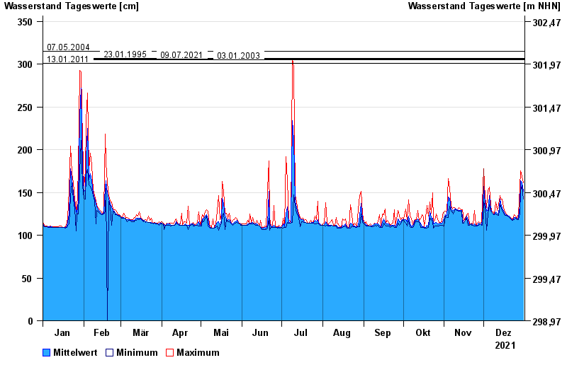
- 07.05.2004 Wasserstand: 315 cm
- 23.01.1995 Wasserstand: 307 cm
- 09.07.2021 Wasserstand: 306 cm
- 03.01.2003 Wasserstand: 305 cm
- 13.01.2011 Wasserstand: 301 cm
| Date | Mean value [cm] | Maximum [cm] | Minimum [cm] |
|---|---|---|---|
| 31.12.2021 | 151 | 161 | 142 |
| 30.12.2021 | 162 | 169 | 158 |
| 29.12.2021 | 164 | 175 | 151 |
| 28.12.2021 | 134 | 156 | 125 |
| 27.12.2021 | 121 | 125 | 118 |
| 26.12.2021 | 119 | 120 | 118 |
| 25.12.2021 | 121 | 122 | 120 |
© Bayerisches Landesamt für Umwelt 2024