
- Start >
- Rivers >
- Waterlevel >
- Bayern >
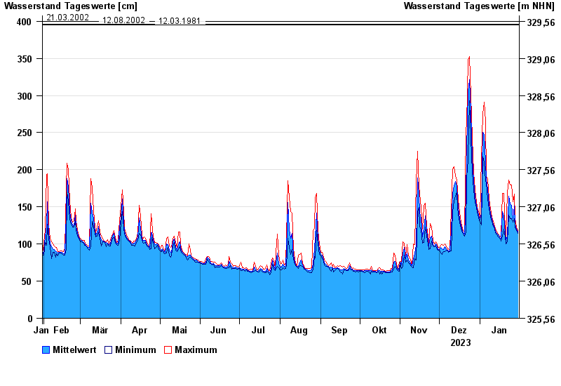
- Kalteneck >
- Chart of year

Chart of year Kalteneck / Ilz
Waterlevel from 31.01.2023 to 30.01.2024
- 21.12.1993 Wasserstand: 477 cm
- 16.03.2019 Wasserstand: 439 cm
- 21.03.2002 Wasserstand: 400 cm
- 12.08.2002 Wasserstand: 396 cm
- 12.03.1981 Wasserstand: 395 cm
| Date | Mean value [cm] | Maximum [cm] | Minimum [cm] |
|---|---|---|---|
| 30.01.2024 | 116 | 118 | 114 |
| 29.01.2024 | 120 | 123 | 118 |
| 28.01.2024 | 127 | 135 | 123 |
| 27.01.2024 | 151 | 167 | 134 |
| 26.01.2024 | 134 | 157 | 129 |
| 25.01.2024 | 152 | 180 | 134 |
| 24.01.2024 | 154 | 180 | 134 |
© Bayerisches Landesamt für Umwelt 2024