
- Start >
- Rivers >
- Waterlevel >
- Bayern >
- Hallerndorf >
- Chart of year

Chart of year Hallerndorf / Aisch
Waterlevel from 01.01.2021 to 31.12.2021
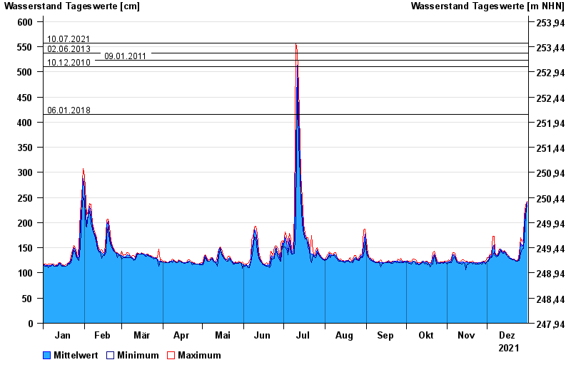
- 10.07.2021 Wasserstand: 557 cm
- 02.06.2013 Wasserstand: 537 cm
- 09.01.2011 Wasserstand: 523 cm
- 10.12.2010 Wasserstand: 510 cm
- 06.01.2018 Wasserstand: 415 cm
| Date | Mean value [cm] | Maximum [cm] | Minimum [cm] |
|---|---|---|---|
| 31.12.2021 | 241 | 243 | 235 |
| 30.12.2021 | 224 | 235 | 215 |
| 29.12.2021 | 202 | 215 | 169 |
| 28.12.2021 | 157 | 169 | 149 |
| 27.12.2021 | 153 | 162 | 147 |
| 26.12.2021 | 160 | 170 | 139 |
| 25.12.2021 | 129 | 139 | 125 |
© Bayerisches Landesamt für Umwelt 2024