
- Start >
- Rivers >
- Waterlevel >
- Bayern >
- Hallerndorf >
- Chart of year

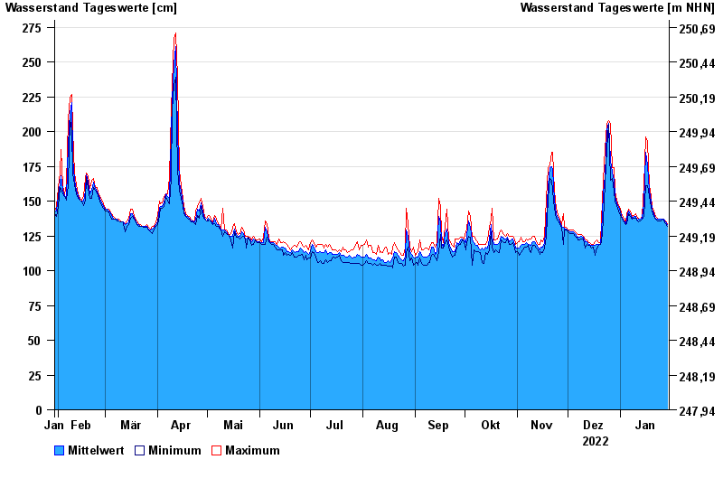
Chart of year Hallerndorf / Aisch
Waterlevel from 30.01.2022 to 29.01.2023
- 10.07.2021 Wasserstand: 557 cm
- 02.06.2013 Wasserstand: 537 cm
- 09.01.2011 Wasserstand: 523 cm
- 10.12.2010 Wasserstand: 510 cm
- 06.01.2018 Wasserstand: 415 cm
| Date | Mean value [cm] | Maximum [cm] | Minimum [cm] |
|---|---|---|---|
| 29.01.2023 | 133 | 134 | 132 |
| 28.01.2023 | 135 | 136 | 134 |
| 27.01.2023 | 137 | 137 | 136 |
| 26.01.2023 | 137 | 137 | 137 |
| 25.01.2023 | 137 | 137 | 136 |
| 24.01.2023 | 137 | 137 | 136 |
| 23.01.2023 | 137 | 138 | 136 |
© Bayerisches Landesamt für Umwelt 2024