
- Start >
- Rivers >
- Waterlevel >
- Bayern >
- Gschwend >
- Current values

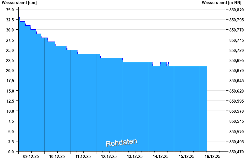
Current values Gschwend / Rottach
Waterlevel from 09.12.2025 to 16.12.2025
- Hochwassergefahrenfläche HQ100 150 cm
| Date | Waterlevel [cm] |
|---|---|
| 15.12.2025 22:30 | 21 |
| 15.12.2025 22:15 | 21 |
| 15.12.2025 22:00 | 21 |
| 15.12.2025 21:45 | 21 |
| 15.12.2025 21:30 | 21 |
| 15.12.2025 21:15 | 21 |
| 15.12.2025 21:00 | 21 |
© Bayerisches Landesamt für Umwelt 2025