
- Start >
- Rivers >
- Waterlevel >
- Bayern >
- Grabmühle >
- Chart of year

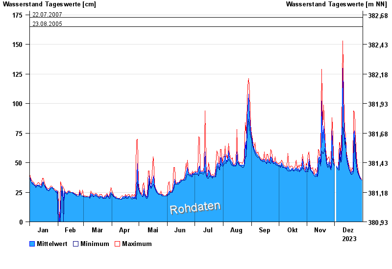
Chart of year Grabmühle / Donaumoos Ach
Waterlevel from 01.01.2023 to 31.12.2023
- 10.03.2006 Wasserstand: 220 cm
- 16.02.2006 Wasserstand: 205 cm
- 03.06.2013 Wasserstand: 196 cm
- 22.07.2007 Wasserstand: 193 cm
- 23.08.2005 Wasserstand: 185 cm
| Date | Mean value [cm] | Maximum [cm] | Minimum [cm] |
|---|---|---|---|
| 31.12.2023 | 35 | 36 | 35 |
| 30.12.2023 | 36 | 37 | 36 |
| 29.12.2023 | 38 | 38 | 37 |
| 28.12.2023 | 39 | 39 | 38 |
| 27.12.2023 | 41 | 42 | 40 |
| 26.12.2023 | 44 | 47 | 42 |
| 25.12.2023 | 50 | 55 | 47 |
© Bayerisches Landesamt für Umwelt 2025