
- Start >
- Rivers >
- Waterlevel >
- Bayern >
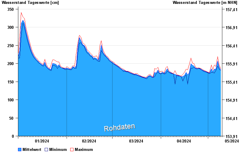
- Gemünden Lachsfangsteg >
- Chart of year

Chart of year Gemünden Lachsfangsteg / Sinn
Waterlevel from 01.01.2024 to 09.05.2024
- 03.01.2003 Wasserstand: 389 cm
- 24.12.1967 Wasserstand: 386 cm
- 23.02.1970 Wasserstand: 373 cm
- 14.01.2011 Wasserstand: 369 cm
- 23.01.1995 Wasserstand: 362 cm
| Date | Mean value [cm] | Maximum [cm] | Minimum [cm] |
|---|---|---|---|
| 09.05.2024 | 184 | 186 | 182 |
| 08.05.2024 | 190 | 196 | 184 |
| 07.05.2024 | 207 | 219 | 193 |
| 06.05.2024 | 184 | 192 | 180 |
| 05.05.2024 | 184 | 196 | 174 |
| 04.05.2024 | 178 | 183 | 175 |
| 03.05.2024 | 185 | 196 | 175 |
© Bayerisches Landesamt für Umwelt 2024