
- Start >
- Rivers >
- Waterlevel >
- Bayern >
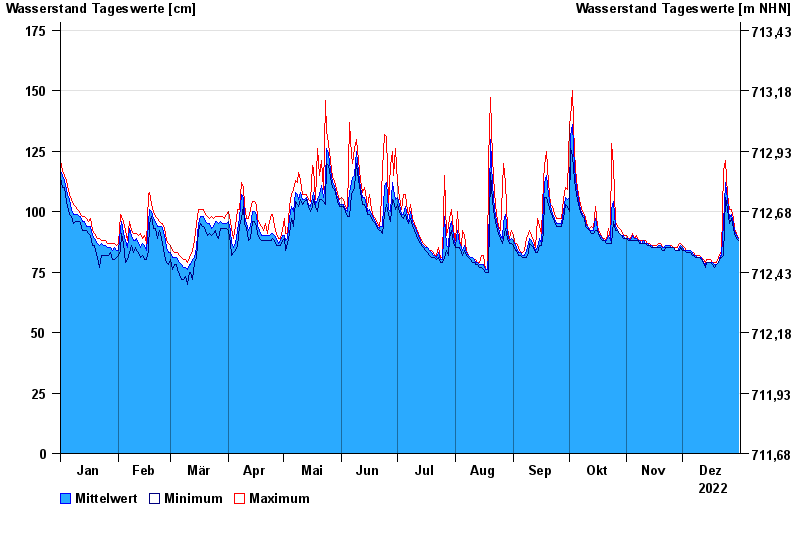
- Garmisch o. d. Partnachmündung >
- Chart of year

Chart of year Garmisch o. d. Partnachmündung / Loisach
Waterlevel from 01.01.2022 to 31.12.2022
- 22.05.1999 Wasserstand: 288 cm
- 23.08.2005 Wasserstand: 282 cm
- 12.08.2002 Wasserstand: 231 cm
- 31.08.2010 Wasserstand: 216 cm
- 11.06.1965 Wasserstand: 216 cm
| Date | Mean value [cm] | Maximum [cm] | Minimum [cm] |
|---|---|---|---|
| 31.12.2022 | 89 | 89 | 88 |
| 30.12.2022 | 90 | 91 | 89 |
| 29.12.2022 | 92 | 93 | 91 |
| 28.12.2022 | 95 | 97 | 93 |
| 27.12.2022 | 99 | 101 | 97 |
| 26.12.2022 | 97 | 101 | 95 |
| 25.12.2022 | 105 | 107 | 101 |
© Bayerisches Landesamt für Umwelt 2024