
- Start >
- Rivers >
- Waterlevel >
- Bayern >
- Garmisch o. d. Partnachmündung >
- Chart of year

Chart of year Garmisch o. d. Partnachmündung / Loisach
Waterlevel from 05.12.2020 to 04.12.2021
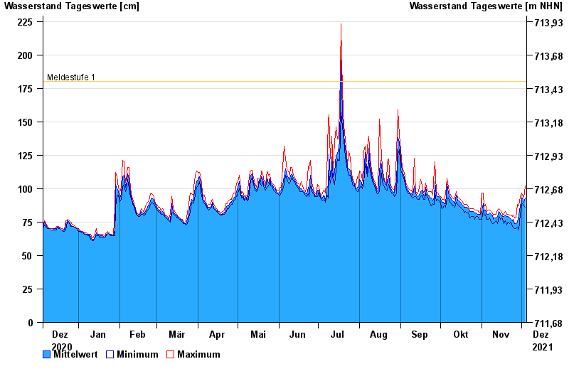
- Meldestufe 1 180 cm
- Meldestufe 4 260 cm
- Hochwassergefahrenfläche HQ100 330 cm
| Date | Mean value [cm] | Maximum [cm] | Minimum [cm] |
|---|---|---|---|
| 04.12.2021 | 93 | 102 | 86 |
| 03.12.2021 | 90 | 93 | 87 |
| 02.12.2021 | 93 | 95 | 89 |
| 01.12.2021 | 93 | 97 | 88 |
| 30.11.2021 | 87 | 94 | 81 |
| 29.11.2021 | 80 | 87 | 69 |
| 28.11.2021 | 75 | 88 | 71 |
© Bayerisches Landesamt für Umwelt 2024