
- Start >
- Rivers >
- Waterlevel >
- Bayern >
- Fürsteneck >
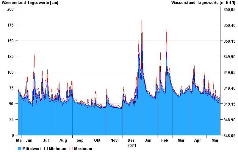
- Chart of year

Chart of year Fürsteneck / Wolfsteiner Ohe
Waterlevel from 26.05.2021 to 25.05.2022
| Date | Mean value [cm] | Maximum [cm] | Minimum [cm] |
|---|---|---|---|
| 25.05.2022 | 61 | 64 | 57 |
| 24.05.2022 | 60 | 64 | 55 |
| 23.05.2022 | 55 | 57 | 51 |
| 22.05.2022 | 56 | 57 | 54 |
| 21.05.2022 | 58 | 62 | 51 |
| 20.05.2022 | 57 | 58 | 55 |
| 19.05.2022 | 57 | 59 | 55 |
© Bayerisches Landesamt für Umwelt 2024