
- Start >
- Rivers >
- Waterlevel >
- Bayern >
- Freising >
- Chart of year

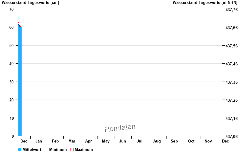
Chart of year Freising / Moosach
Waterlevel from 10.12.2025 to 09.12.2026
- 23.06.1992 Wasserstand: 148 cm
- 31.07.1990 Wasserstand: 132 cm
- 11.07.1995 Wasserstand: 123 cm
- 03.06.1992 Wasserstand: 121 cm
- 29.06.2006 Wasserstand: 120 cm
| Date | Mean value [cm] | Maximum [cm] | Minimum [cm] |
|---|---|---|---|
| 16.12.2025 | 60 | 60 | 60 |
| 15.12.2025 | 60 | 60 | 60 |
| 14.12.2025 | 60 | 61 | 60 |
| 13.12.2025 | 61 | 61 | 60 |
| 12.12.2025 | 61 | 61 | 61 |
| 11.12.2025 | 61 | 62 | 61 |
| 10.12.2025 | 62 | 63 | 62 |
© Bayerisches Landesamt für Umwelt 2025