
- Start >
- Rivers >
- Waterlevel >
- Bayern >
- Engen >
- Chart of month

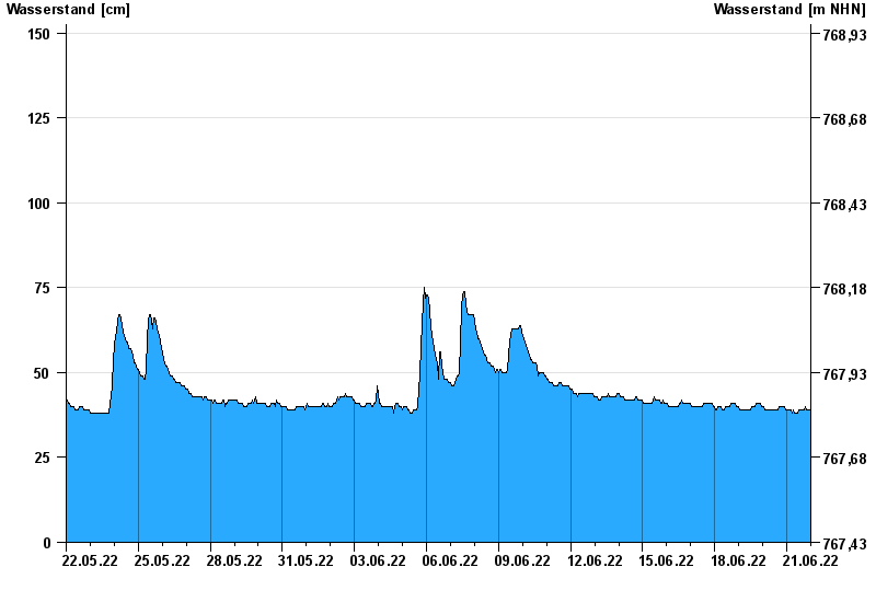
Chart of month Engen / Illach
Waterlevel from 22.05.2022 to 21.06.2022
- 30.07.1990 Wasserstand: 225 cm
- 22.05.1999 Wasserstand: 214 cm
- 23.08.2005 Wasserstand: 207 cm
- 18.06.1979 Wasserstand: 206 cm
- 04.07.1975 Wasserstand: 206 cm
| Date | Waterlevel [cm] |
|---|---|
| 22.06.2022 00:45 | 40 |
| 22.06.2022 00:30 | 40 |
| 22.06.2022 00:15 | 39 |
| 22.06.2022 00:00 | 39 |
| 21.06.2022 23:45 | 39 |
| 21.06.2022 23:30 | 39 |
| 21.06.2022 23:15 | 39 |
© Bayerisches Landesamt für Umwelt 2024