
- Start >
- Rivers >
- Waterlevel >
- Bayern >
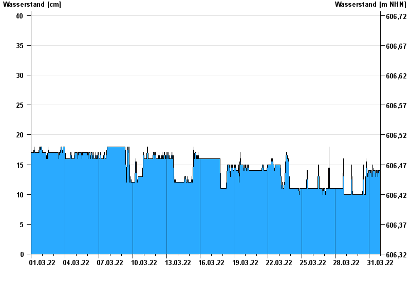
- Dürnhausen >
- Chart of month

Chart of month Dürnhausen / Lothdorfer Bach
Waterlevel from 01.03.2022 to 31.03.2022
note
Messwerte beeinflusst durch Kraftwerkssteuerungen. Abflusswerte zu niedrig nach Profiländerung. Muss angepasst werden
- 06.06.1968 Wasserstand: 149 cm
- 22.05.1999 Wasserstand: 144 cm
- 18.06.1979 Wasserstand: 140 cm
- 10.08.1970 Wasserstand: 121 cm
- 27.06.2009 Wasserstand: 119 cm
| Date | Waterlevel [cm] |
|---|---|
| 01.04.2022 00:45 | 14 |
| 01.04.2022 00:30 | 14 |
| 01.04.2022 00:15 | 13 |
| 01.04.2022 00:00 | 14 |
| 31.03.2022 23:45 | 13 |
| 31.03.2022 23:30 | 14 |
| 31.03.2022 23:15 | 14 |
© Bayerisches Landesamt für Umwelt 2024