
- Start >
- Rivers >
- Waterlevel >
- Bayern >
- Druisheim >
- Chart of year

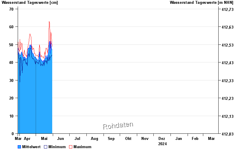
Chart of year Druisheim / Schmutter
Waterlevel from 29.03.2024 to 28.03.2025
- Hochwassergefahrenfläche HQ100 230 cm
| Date | Mean value [cm] | Maximum [cm] | Minimum [cm] |
|---|---|---|---|
| 06.06.2024 | 70 | 72 | 68 |
| 05.06.2024 | 86 | 109 | 69 |
| 04.06.2024 | 144 | 207 | 109 |
| 03.06.2024 | 250 | 261 | 209 |
| 02.06.2024 | 238 | 262 | 217 |
| 01.06.2024 | 160 | 217 | 96 |
| 31.05.2024 | 65 | 95 | 48 |
© Bayerisches Landesamt für Umwelt 2024